Land-use and an ecological plan around the Bot Estuary.
A land-use and an ecological plan around the Bot Estuary is necessary as a first step in establishing a sound,…


Management of the Bot River Estuary: Part 2, changed dynamics and suggestions follows on from part 1.
The Bot River Estuary has reached what appears to be a new normal state. The estuary remains open to the sea with the possibility of fish species entering to spawn in the estuary The shoreline has stabilised at just over a metre of water; this is slowly rising, without the estuary closing. The dynamics at the mouth of the estuary were severely changed by the opening position of the artificial breach. This was reported in Botfriends Facebook and now Greenheart website (the Botfriends website is discontinued) with many pictures.
Even the large storm of 14 March 2021 did not change the depth of the estuary except for a few days, as the additional input of storm water was spread over the larger surface area of the estuary. The force of the additional input was dissipated over the estuary. This additional water then drained out over a few days. Normally, such a storm would have caused more sand to be washed out of a fully open mouth estuary at low tide, opening the breach wider. However, this did not occur. The result is that more sand has been deposited near the mouth of the estuary and more silt has been deposited in the upper reaches of the Bot and Afdaks Rivers.
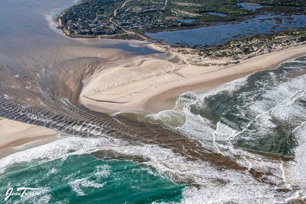
The changed dynamics of the Bot Estuary at its mouth have effectively caused the bund, the sand across the mouth of the estuary, which normally closes the estuary to be about six times wider than normal. This is as a result of the very large volume of sand from the scoured-out old dune to be spread back into the estuary. There is now more than a metre of sand deposited in the area, from the Keel across to halfway down Meerensee. Even the deeper channel winding through this additional sand has had more sand deposited. This causes a relatively slow movement of water, dropping from about a metre above sea level to sea level, over more than half a kilometre at low tide. Effective scouring is not occurring at the mouth.
At high tide, what little sand that is washed out gets returned, and the raised addition bed of sand reduces wave action into the estuary. This results in much less sea water entering the estuary at high tide with reduced waves into the estuary, reducing the salinity of the estuary. This then consists of a greater proportion of fresh water input from the Bot and Afdaks. Normally, the estuary in an open situation is much more tidal, changing from sea level to as much as 1700 mm above sea level, with an average of around a 1000mm with the tides. In a normal breach, as the tide rises a considerable amount of sea water enters the estuary and drops again at low tide, twice a day, this is a considerable amount of water, providing a strong scouring effect. The new normal situation is only about 200-250mm of tidal action, varying around the high tide mark rather than the low tide mark.
It would appear that this situation may remain for a considerable time, steadily building the sand within the estuary. Should the estuary eventually close, it will then build up water to 2.5 to 3 metres above sea level. A natural breach is even less likely to occur over the great new distance. When breached naturally or artificially, it will probably only drop to about 1 metre above sea level, with much less scouring occurring, reinforcing the present new normal state.
The existing EMP (Estuary Management Policy) is even less applicable to this new normal state. The breach of the estuary at Rooisand was a disaster with minimal scouring, fish deaths and disruption of the system. Have we not changed the dynamics at the mouth to a similar situation? There is very reduced sea water input into the estuary. There is less mixing of saline and fresh water. The upper reaches of the Bot and Afdaks are even more fresh water, extending much further down the estuary.
If the present position with around 1 to 1.5 metres of water above sea level can be maintained, with minimal management, the advantages are: a nursery area for the saline fish species, a greater area of the saline part of the estuary, a more stable and sustainable true estuary in the lower reaches, sufficient water for boating and other activities and less rapid, large changes with the resultant die-off of saline flora and fauna. The size of the estuary could be expanded into the now-exposed mud flats with some dredging. This would provide increased shallow water habitat for the saline water species of fish and birds who frequent saline estuary conditions.
Under the past and present management plan, the upper reaches of the Bot and Afdaks parts of the estuary are pretty much fresh water systems. The expansion of reeds much lower down the Bot and Afdaks inlets, in the last few years, indicates much less salt mixing into these areas as this would kill off the reeds. There has also been a massive accumulation of silt, especially where the reeds have expanded, but also in the open water areas. Where exposed shale was visible a few years ago, this is now covered with at least a half metre of silt.
The changed dynamics of the Bot Estuary warrants the consideration of the following. The upper reaches of both the Bot and Afdaks could be converted to fresh water systems, using the dredged accumulation of the silt in these areas cost effectively. These could be maintained at 2.5 to 3 metres above sea level. If managed correctly, there would be:
We then can turn the disaster which has occurred, to cater for all the objectives outlined in the management plan from as early as the CSIR report of 1982, into an environmentally stable, sustainable water paradise where we are working with nature and have increasing resources available to the people around the estuary.
Michael Austin (A friend of the Bot Estuary) 26 March 2021
The latest post on management is ‘Land use and ecological plan for the Bot Estuary‘ on Greenheart website. A new management plan for the area has been gazetted and about to be published. This has caused much debate locally and Fisherhaven Homeowners had the issue on their agenda. This is also covered by the Greenheart Facebook page.

Recent Comments