Land-use and an ecological plan around the Bot Estuary.
A land-use and an ecological plan around the Bot Estuary is necessary as a first step in establishing a sound,…


The Bot River Estuary by Michael Austin, publication in CONNECT
Lead article in the Arabella Homeowners for Homeowners Newsletter,

October 2021
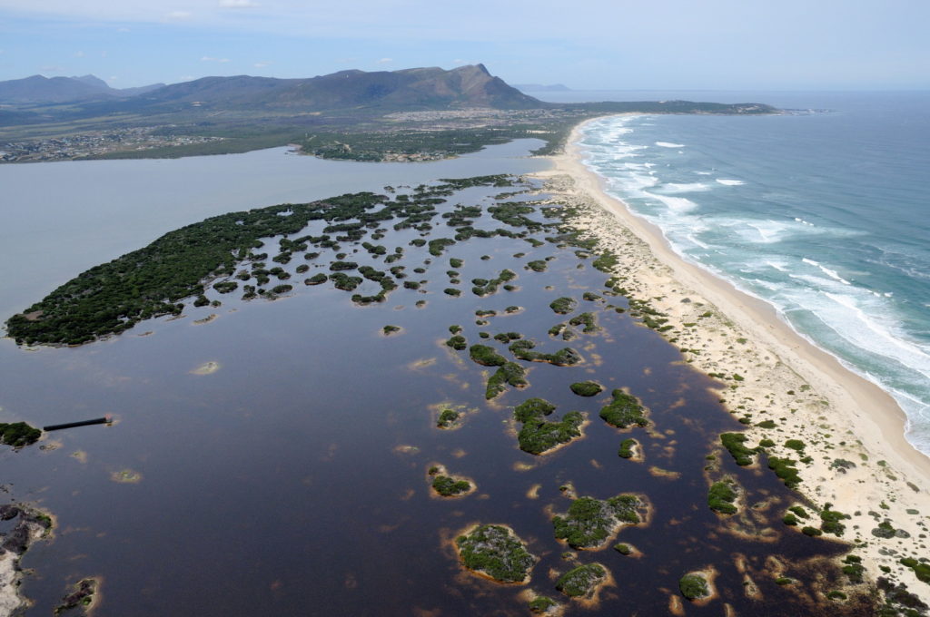
The Bot River Estuary is a complex ecosystem with many interacting aspects. It is a combination of fresh water as well as salt water input from the sea. The main body of water is below sea level but after a breach the level varies from low to high tide levels twice every 24 hours. The input of sea water, as the tide rises, is significantly more than the fresh water input. As the tide drops, much scouring (removal of sand) occurs as the water level drops back to the low tide mark.
The closure of the mouth considerably reduces the seawater input, so then most of the input is from fresh water. The estuary can rise to about 3 to 3.5 metres above sea level, when it would normally breach itself. From about the 2-metre mark, a fair amount of water starts draining out via the keel (the link between the Bot Estuary and the Kleinmond estuary), past the bird hide at Rooisand to the Lamloch swamps and into the Kleinmond estuary. Other losses from the estuary are from evaporation and seepage into the sea through the closure bund (the strip of sand along the beach) and sand dunes.
The Bot River, which includes the Swart River and Houwhoek River, is the main catchment. The Hopies River also flows into the Bot, from the west. The Swart River is a large catchment area, but with low rainfall. Afdaks River has a relatively large catchment, but has a low rainfall with the potential to flood. The invasion of severe alien plant species has reduced this to a trickle.
The Paddavlei River, which starts on Hoek van die Berg, is small but significant. This is cut off in Hawston by a pipeline that takes the water into the sand dune field between Middelvlei and Hawston (a different ecosystem). From there it no longer drains into the estuary, but directly to the sea. The lower Paddavlei drains directly into the estuary and contains pollutants from Hawston and the sewage farm. At this stage, the estuary is large enough to handle this situation. However, there is visible evidence of pollution in the bay section of the estuary near Middelvlei.
The agricultural use of water in the catchment of the estuary has considerably reduced the inflow of fresh water into the estuary. A second major reduction of water input is caused by the spread of alien species into the catchment areas of the rivers. A management plan is required to try to balance and maintain the biodiversity of the estuary. This is done mainly by artificial breaching of the estuary which allows fish exchanges with the sea. The estuary is an important breeding area for a number of saline fish species. The breaching of the estuary also achieves scouring of the accumulated silt and sand. However, the estuary is tending towards a fresh water system with an accumulation of silt. In time, this accumulation will change the estuary into a muddy swamp, choked with reeds, if scouring does not happen.
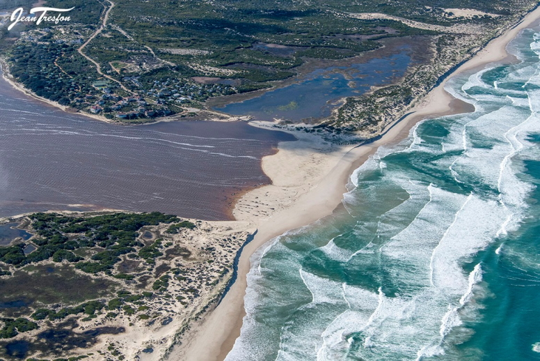
Much of the additional sand from the environmental damage of the artificial breach has been washed back into the estuary. This has resulted in a long river channel, flowing through all the accumulated sand within the estuary. Normally in a breached situation, the estuary has a wide mouth varying from sea level to below sea-level The new river channel itself now slopes towards the sea from above 1m above sea level, sloping towards the sea. The mouth through the bund is also much narrower than usual. The new river channel now slopes towards the sea from above a 1-metre above sea level. All the additional sand build-up has reduced tidal action so much that the water level of the estuary has built up to around 1.5 metres above sea level, even though the mouth remains open.
Even the heavy rains from May to August 2021 failed to provide for enough scouring to take place. The natural dynamics of the estuary have thus been changed considerably since the artificial breach.
The existing management plan is based on very old data, much of which has changed considerably in the last 40 years. Cape Nature and various other government members, including the Overstrand Municipality, are represented on the breaching committee.
When the estuary breaches, the abrupt change in the shoreline exposes large mud flats that consist of sand, silt, saline plants, and many other micro-organisms. These begin to decay and cause the smell. Near Arabella, the very dense reeds are left exposed and tend to die back in the dry summer months, so a considerable amount of decay occurs. Reeds have recently recovered and further expanded with the good rains from May to August 2021. The lack of tidal action inputting large volumes of seawater into the estuary would normally have controlled the reed expansion. This has not occurred in both the Bot River or Afdaks section. This, therefore, allows more silt to build up and be retained, leading to further expansion of the reeds.
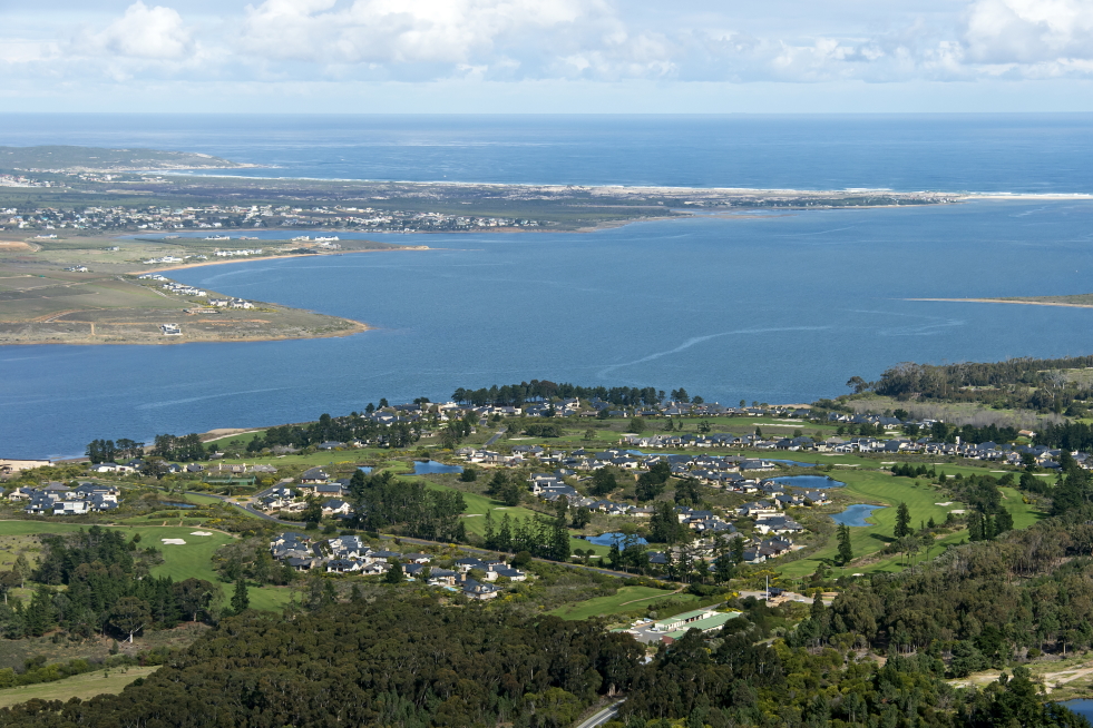
The original inhabitants of the estuary were the Khoisan. Hawston developed as a settlement and trading post with good grazing for horses and oxen and a fresh water supply. This area also produced vegetables on the wetland areas. The better-developed soils in the Arabella area provided more food mostly for grazing, because of the lack of standing fresh water.
In the upper reaches of the estuary, the fish are fresh water species that have adapted to the slightly saline water. Many sea species use the estuary to breed: the small fish have adapted to the saline conditions and are protected from the typical sea predators when the estuary is closed. When the estuary breaches again, they return to the sea. The fishermen exploit this return to the sea when the estuary is breached. In closed conditions the fishing is also good, but often over-exploited with the use of gill nets, which are illegal, and not very well policed.
During WW2 when sea planes were maintained in Fisherhaven, the objective was to maintain a large open body of water on which to land these planes. Some dredging was done around Fisherhaven and a channel was provided to allow drainage to Kleinmond to occur, so that the estuary did not breach. This then provided a long enough landing area for the planes. There is still evidence of the dredging as the deepest part of the estuary is still outside of the main Bot River channel in the Afdaks section.
Much of this is now silting up, with more than half a metre of silt being built up in the last few years. This is also happening adjacent to Arabella, mostly from reed encroachment.
Considerable reed spread has also occurred in the Afdaks section. Unfortunately, the reed beds tend towards very dense single species. Much of the biodiversity is lost because this only really occurs at the intersection of the reeds and the water. The bulk grazers of the reeds are gone and there are no hippopotami to provide many open channels through the reed beds.
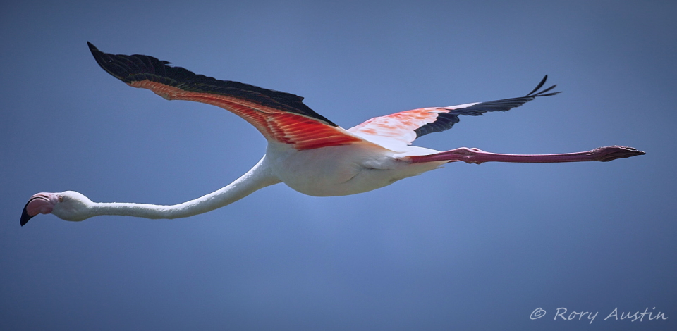
Many of the wetlands around the estuary have also been invaded by reeds or by aliens such as Port Jackson, which dry out the wetland, allowing a further spread of aliens. The flamingos which exploited these wetlands and the shallow areas of the estuary no longer have this abundant food supply. This has led to the reduction of flamingo visitors.
Better control of alien species such as Port Jackson, Australian Myrtle, pines, gum trees, and reed invasions can re-establish the wetlands, providing greater biodiversity, cleaner water and a more biodiverse estuary. This will lead to a more stable and sustainable estuary and surrounds for the future.
The question is whether to implement the man made breaches? The idea of the management plan of the estuary is to try to manage the estuary as little as possible to maintain it as a breeding place for saline fish species and to allow maximum scouring to maintain an open body of water.
Michael Austin, October 2021
A number of reports and many pictures are available on the recent estuary breaches on Greenheart website: https://greenheart.co.za
Michael Austin is the owner of Greenheart Projects and focuses on building management competencies and carrying out planning and environmental assessments. He has many years of experience and extensive knowledge in these fields. In addition, Greenheart Projects carries out environmental and eco-friendly plot clearing of alien species in the Overstrand area.
The Bot River Estuary publication appeared as the lead article in:
Arabella’s newsletter, from Homeowners for Homeowners. There are other Greenheart publications on the environment.

Recent Comments