Land-use and an ecological plan around the Bot Estuary.
A land-use and an ecological plan around the Bot Estuary is necessary as a first step in establishing a sound,…

The Bot Estuary extensively damaged from the breach has been ‘open’ for 13 months with environmental damage occurring throughout this period.
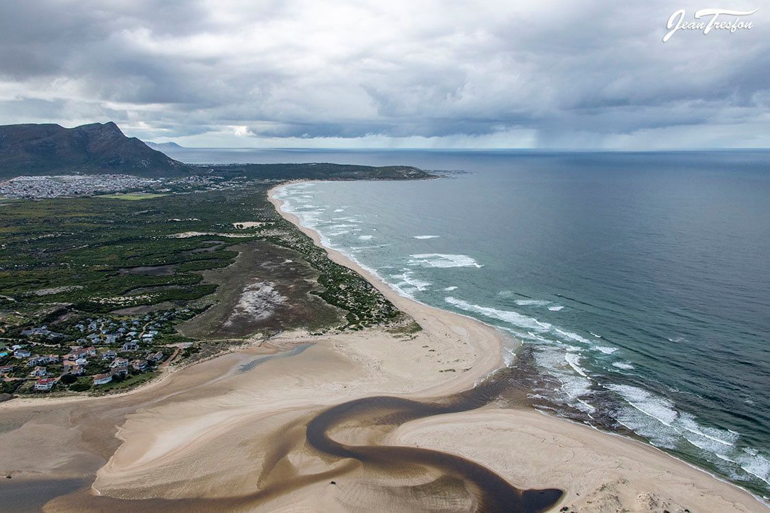
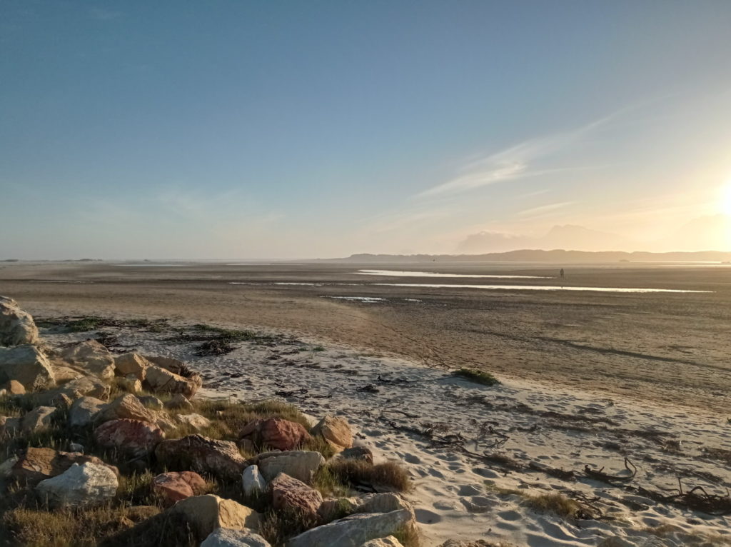
The Bot River estuary was breached artificially on 21 July 2020. It was breached in the wrong place, too far to the west against the recommendations of the Bot Estuary management plan. This caused a huge sand dune to be washed out overnight. The additional sand caused a much bigger than normal spit of sand to stretch out to sea. Unfortunately, this resulted in changing the seas actions, which eroded an adjacent vegetated dune to the west of the breach which increased the size of the spit of sand in the sea. The Bot Estuary damage was immediate and continued for another month with the erosion of the vegetated dune.
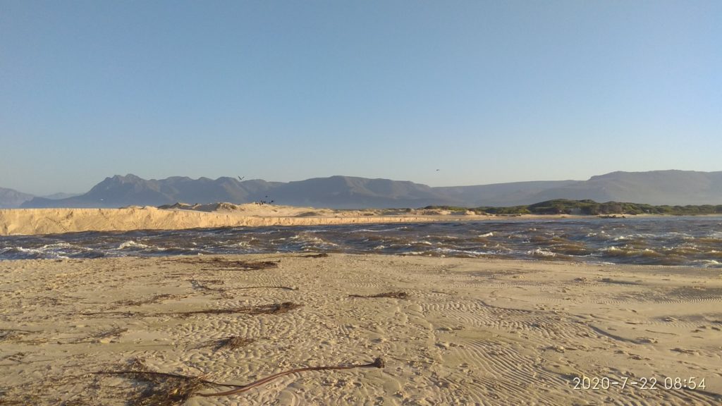
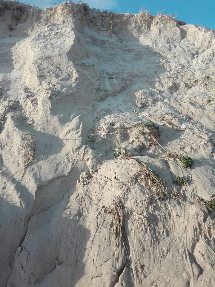
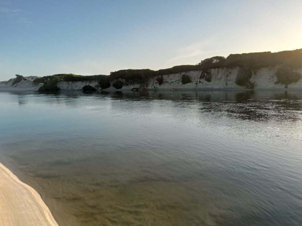
Part of the spit got washed back into the breach and the estuary closed within 23 days. The estuary then built up to over 2m, in less than a month, and the estuary breached itself again in more or less the same position on 3rd September 2020. Although, the deepest part of the breach was more to the east. The vegetated dune continued to erode and much of the sand started to be washed into the estuary and deposited behind the narrow bund. The deep-water channel within the estuary, established by the first breach close to the western shore continued to move further west eroding more of the western bank of the estuary, leaving large woody plants scattered over the estuary These are a danger to boating in the estuary. This damage to the Bot estuary continued for many months.
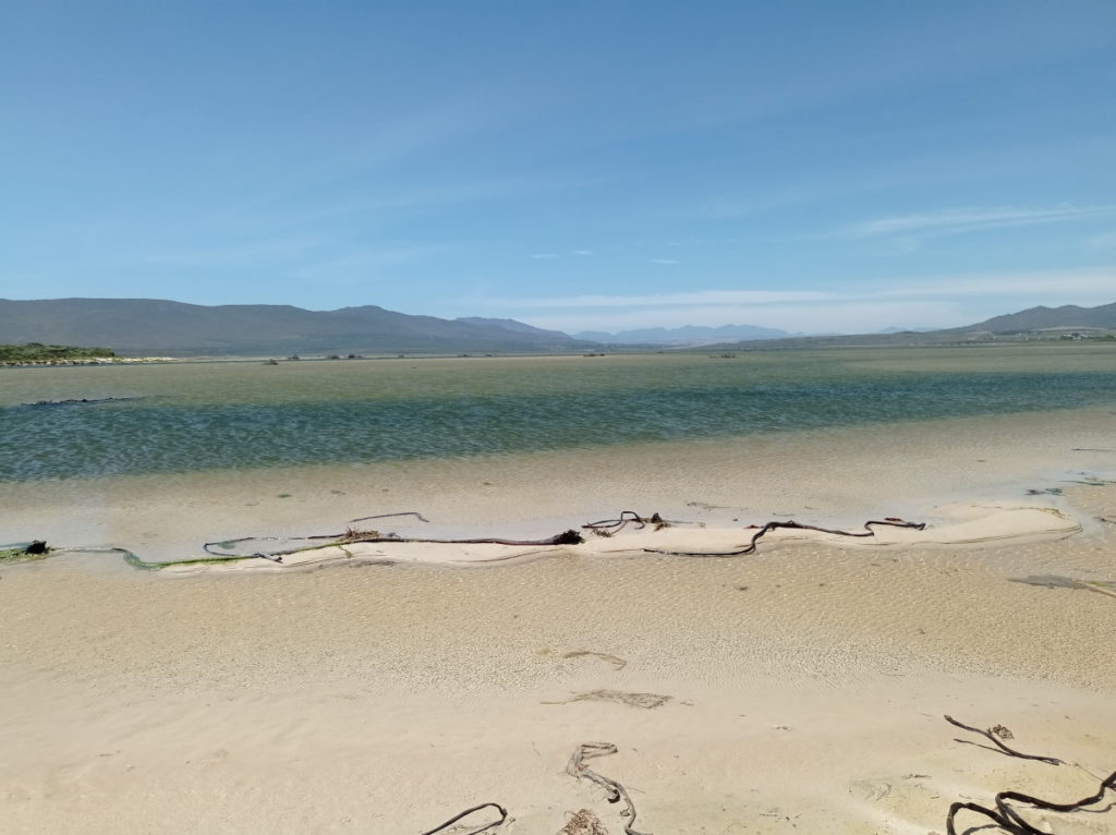
Most of the sand on the spit which stretched out to sea, got washed back into the estuary. At least the removal of the spit stopped the erosion of the vegetated dune and the beach/wave interface area returned to its normal area. However, the vast amount of extra sand now deposited within the estuary caused a slope to develop within the deep-water channel which caused the estuary level to rise. This severely reduced the tidal action, which would normally remove sand deposited by the last high tide. This has caused a net gain of sand within the estuary over many months. The estuary has developed into more of a lagoon with a river stretching from about the keel to the sea which is kept open by the continuous input of the Bot River. Over a year later the estuary still remains open, apparently the longest time recorded. Further damage to the Bot Estuary was the massive amount of sand deposit continuing, the west bank erosion within the estuary and little tidal action.

These changed dynamics of the estuary are causing a very different system to be developing. The lack of tidal inflow means much less sea water daily entering the open estuary. The main input is now fresh water, which now extends to much closer to the mouth. The sea fish species which normally used the estuary as a breeding ground, have a very limited area to breed and the encroachment of reeds, which are normally killed by salt water has significantly increased. The reeds act as silt traps further advancing the reeds into what used to be deeper water.
Even the big storms of 2021 were unable do much about all the additional sand and silt that has built up in the estuary and the build up seems to have accelerated with the new dynamic prevailing in the estuary. With the dry months over the summer, maybe the estuary will close with the build up of a narrow bund on the seashore but indications are that this may not happen.
BREF put out a report on the estuary breach which made NO of mention of the extensive environmental damage caused by breaching the Bot Estuary in the wrong place. In addition, they made a simple calculation error in their report which equated the volumes in the estuary only to the depth of the estuary rather than the depth X the area. This was reported to them and their only conclusion was that the area was taken into account and the matter closed. The graphic they produced and the conclusions from it are as much as 100% out. Unfortunately, this only compounds the other errors in their report and they have failed to admit to any errors that a school boy could see for themselves.
All of the above observations are well documented with numerous pictures and videos from the general public and a number of reports made on the estuary breach during the development of the dynamic which now exists. At no point have the conclusions been questioned. The last report to BREF was internal to BREF and was to be investigated, but this has not occurred. Instead, the multiple errors have been covered up and buried in red tape.
What little data that is gathered on the estuary, were promised to at least the members of BREF years ago but these have not been forthcoming. Other reports of pollution entering the estuary have also not been investigated or poorly explained. Luckily enough, these pollution problems have been relatively small and the estuary is large enough to have absorbed them and dilute them. Nonetheless, these small incidents become accumulative especially over time. The feedback from BREF has been that the estuary still remains below the maximum allowable limits as set by national government. However, should this large estuary be allowed to build up to the maximum limits, where it becomes too costly to try and rectify the problems at that stage. This is exactly what has happened to the Onrus Estuary, which for years now varies around the maximum limits and even a small incident leads to frequent closure of the estuary to the general public. The Bot Estuary is also been used to try and solve the pollution problems of the Kleinmond Estuary, to the detriment of the large much more important Bot Estuary. Officially, this not the case but has been so for years.
The recent changed dynamics of the Bot Estuary are going to compound the damage problems. This was indicated in the literature from 34 years ago as a potential problem (Bally R 1987). It seems that a common-sense approach and explanations are to continue to be ignored until a major disaster occurs within the Bot River Estuary. This is analogous to the climate change disaster which is now occurring on a global scale and from which we may never recover, at best there will be some new normal, which the world has to adapt to, after 40 years of warning by scientists.

Nature, by itself, may still correct some of the problems, of the changed dynamics of the Bot Estuary. We shall have to wait and see. However, we should at least be looking at what has happened in the estuary and try and help nature to recover the situation. Mistakes can be made in the management of complex systems, but these should be admitted, debated and possible solutions proposed. For some activities of course the changed dynamics of the estuary are a good thing. If so the objectives of the management plan of the estuary need to be changed anyway. They certainly need to be revised.
The deep-water channel established by the too far to the west breach, flows almost due west from the centre of the estuary and in turning south again has continued to scour out more of the well vegetated west bank of the estuary over the past year. The evidence of this are the large bushes and trees which are now spread around the estuary and a danger to boats. In fact the whole of the deep-water channel/river, flowing south towards the bund, is now west of the water’s edge in July 2020. When the deep-water gets to the narrow bund, it turns east before emptying into the sea. Over the last year this channel into the sea has moved further east with time and is almost at the centre of the estuary. Nature has been correcting the wrong place that the estuary was breached. The massive damage to the Bot Estuary has continued to build up over more than a year.

Estuary closed again
Reported as closed on 31 October with pictures. After a year of being open as a river mouth, rather than the normal open mouth with considerable tidal exchange the estuary has closed. The existing high level of more than 1.5m is now rising. It is unlikely that it will rise enough over the dry summer months to breach naturally. The sea is steadily building up the closure bund at the sea. Especially the blowing sand dune section, which seems to be extending further east than it was before. The deep
The lowest point of the bund may revert to around the centre of the bund and a natural breach may occur in the right position, maybe next winter. The dynamics may then re-establish themselves to what they were before the 2020 artificial breach. It will probably take a number of breaches before all the additional sand deposited into the estuary is removed. One of the main objectives of breaching is the control of silt from the river system. In the meantime, there will be even more accumulation of silt in the estuary.
The damage to the Bot Estuary can be summarized as:
The estuary may correct itself in time but this could be many years. The incorrect reporting and complete lack of admission to the incorrect position of the breach may lead to further poor management in years to come.
We could end up with this beautiful body of water becoming a reed infested swamp with a river running through it, as it is closing from both north and south.
Michael Austin Greenheart Projects
A number of reports on the estuary breach have been made over time since the breach and are available in https://greenheart.co.za grouped under eco category subgroup estuary breach. They start with estuary breach and end with management suggestions and reports to BREF.

Recent Comments